Rivendell
Sunlight dances through the leaves,
Soft winds stir the sighing trees…
…Time will never touch you,
Here in this enchanted place.
These lyrics from the song Rivendell, written by Neil Peart and performed by Rush, are what came to mind on our second national park visit to Sequoia National Park, on our 2018 Neil Peart Inspired National Park Road Trip.
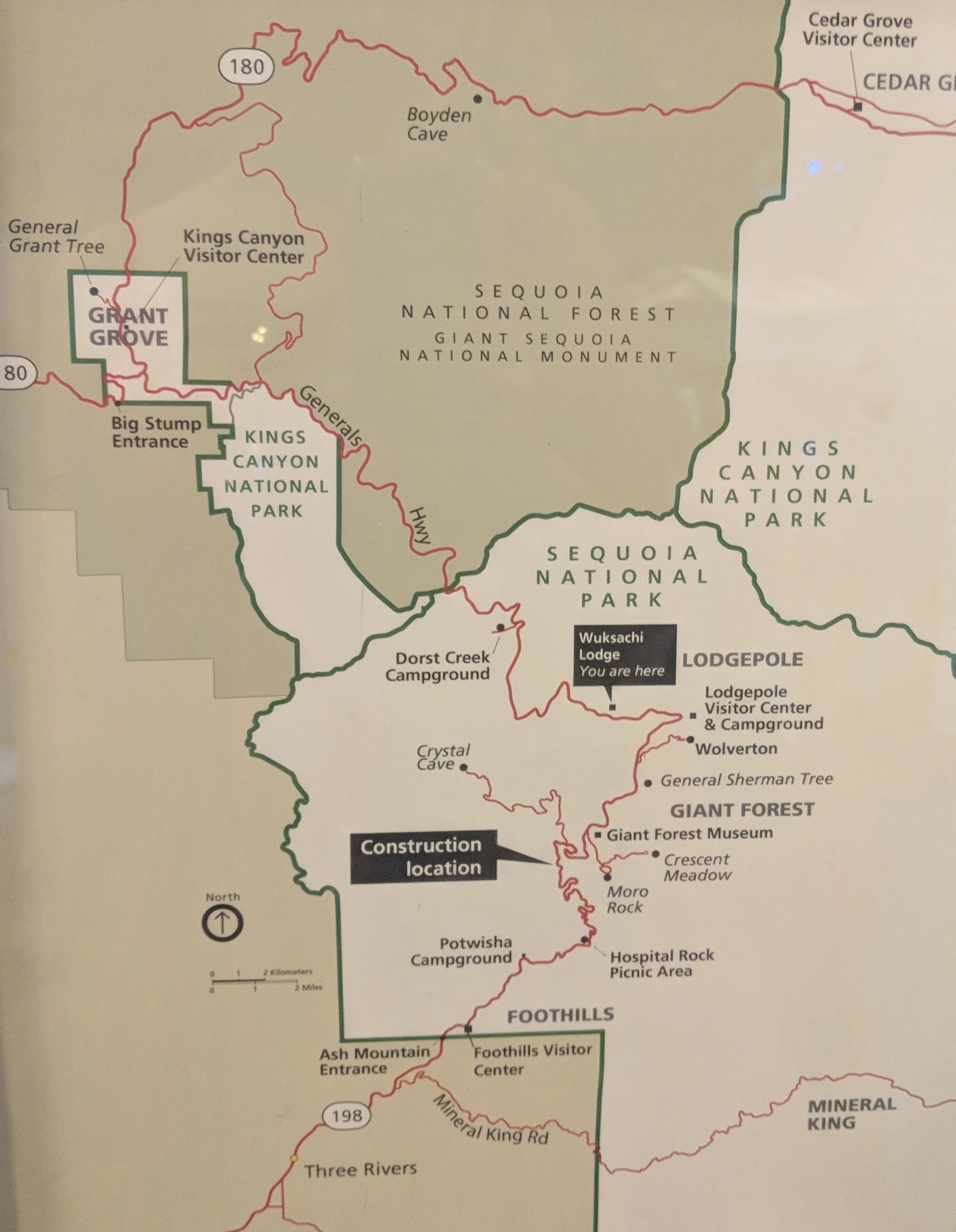
Map of Sequoia National Park
Sequoia National Park happens to be our nation’s second national park. Sequoia was designated a national park by President Benjamin Harrison on September 25, 1890. The park is located in the southern Sierra Nevada range east of Visalia, California. Sequoia shares its northern border with Kings Canyon which became a national park some fifty years later. Today the two parks are administered as one by the national park service. The eastern border of Sequoia extends all the way to the western slope of Mt. Whitney, although the Great Western Divide range blocks the view of this tallest peak from roads on the west side of the park.
Sequoia National Park is open year round. The best time to visit is June through August when the temperature ranges from the 50s to 70s, much cooler than the high temperatures this time of year in the San Joaquin valley to the west. The park is the most crowded on Fridays and Saturdays and on any holiday weekend from Memorial Day to Labor Day. A shuttle service to the park from Visalia to the west and Three Rivers to the south operates from late May to mid September. During the summertime there is a free in-park shuttle. The in-park shuttle also operates during winter holidays including Thanksgiving and Christmas. Much of the park stays open in winter with temporary closures for snow removal. This sometimes includes the Generals Highway from Lodgepole to Grant Grove, the section of highway which connects Sequoia to Kings Canyon. Some roads such as Mineral King and Big Meadows close for winter as does the Crystal Cave Road, which is only accessible when open for tours from mid May to late September.
On one of his visits to Sequoia National Park in July 2003, Neil Peart wrote that he visited the Crystal Cave and Mineral King Valley staying in cabins near Silver City. He described the Mineral King Valley as a “vast amphitheatre of meadows surrounded by high peaks of barren granite above the treeline, still dotted with a few small patches of snow, even in July.” He went on to say “I was moved to compose a Sierra rhapsody dedicated to this ‘Range of Light’ and to John Muir” (Traveling Music, The Soundtrack to My Life and Times).
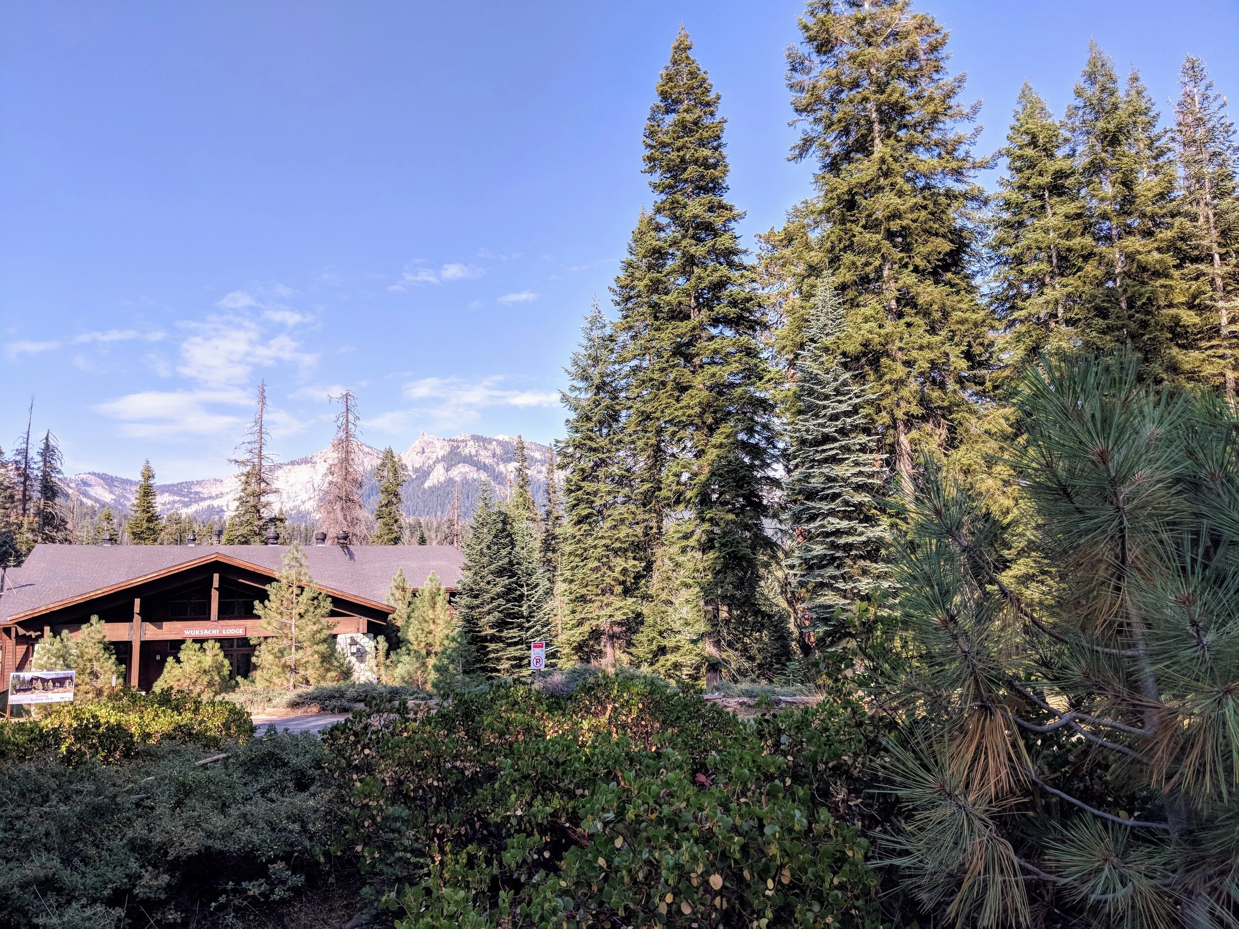
Wuksachi Lodge, Sequoia National Park
There are two visitor centers in Sequoia National Park. The Foothills Visitor Center, open year round, is located on the Generals Highway one mile north of the Ash Mountain entrance. The Lodgepole Visitor Center is located 21 miles north, two miles north of the General Sherman Tree. The Lodgepole Visitor Center is closed from October to May.
Lodging in Sequoia is available at the Wuksachi Lodge, near the General Sherman Tree and Moro Rock. The lodge offers a full restaurant, cocktail lounge and gift shop. For the more adventurous, the Bearpaw High Sierra Camp can be reached via an 11.5 mile wilderness hike with a 1,000 foot elevation gain. The required wilderness permit is included in the stay. Guests stay in one of six tent cabins and enjoy home cooked family style meals.
Dinner at The Peaks, Wuksachi Lodge, Sequoia National Park
There are numerous campgrounds in Sequoia. RVs are allowed in some campgrounds, but there are no RV hookups or dump stations in the park. Vehicles over 22 feet are not advised on the Generals Highway between the Potwisha Campground and Giant Forest and RVs and trucks are not recommended or permitted in some campgrounds. Campgrounds are as follows:
Lodgepole and Giant Forest, 6700 feet: Lodgepole Campground and Dorst Creek Campground
Foothills area, 2500-3000 feet: Potwisha Campground, Buckeye Flat Campground South Fork Campground
Mineral King area, 7500 feet: Atwell Mill Campground, Cold Springs Campground
Sequoia National Park is popular for hiking, rock climbing, backpacking, skiing and snowshoeing. There are several popular attractions, many accessible to all. The General Sherman tree is the world’s largest tree, as measured by volume, at 275 feet tall and a base diameter of 36 feet. Located on the seasonal shuttle stop the tree has disability access from a small lot on the Generals Highway and access from the main trail, a 0.5 mile paved descent with some stairs. The General Sherman is located in the Giant Forest sequoia grove. The Congress Trail starts near the General Sherman tree and is a 2 mile paved loop.
General Sherman
The Crystal Cave is a marble cavern located near the Giant Forest. The cave can be visited by guided tour only; tickets are required. Nearby Tunnel Log is located on Crescent Meadow Road in the Giant Forest. This is a 17 foot wide and 8 foot high tunnel through a fallen sequoia which once stood 275 feet high with a 21 foot diameter base. Also nearby, Moro Rock can be climbed via a 350 step concrete and stone stairway. Views from the top are of the Great Western Divide to the east and the foothills and San Joaquin valley to the west. The road is closed to private vehicles on the weekends in the summer, but can be accessed by the free in park shuttle. Other domes and rocks are accessible to most visitors and some offer established climbing routes for experienced technical climbers. Little Baldy near the Dorst Campground is a 1.7 mile trail with a 1,000 foot climb. Big Baldy starts in Sequoia and ends in King Canyon after a 2.2 mile hike with 600 foot elevation gain. Beetle Rock near Giant Forest is a 5 minute walk and Sunset Rock is a 1 mile nearly flat walk from the Giant Forest Museum or Big Trees trailhead.
Sequoia National Park and Kings Canyon have over 800 miles of trails. Popular hiking trails in Sequoia include the following:
Foothills area
Marble Falls - 3.9 miles
Middle Fork Trail - 3 miles to Panther Creek Falls
Lady Bug Trail - 3 miles, moderately steep
Garfield Grove Trail - 5 miles one way, steep
North Fork Trail
Giant Forest and Lodgepole
General Sherman Tree - ½ mile descent some stairs
The Big Trees Trail - .75 miles paved accessible, 1 hour round trip
Moro Rock - 300 feet, stairs
Tokopah Falls - 1.7 miles one way, easy
Deep Tracks
Mineral King at 7500 feet offers day hiking or backpacking opportunities.
Upper and Lower Monarch Lakes is 4.2 miles one way with a 1200 foot climb to Sawtooth Pass.
Crystal Lake - 4.9 miles one way.
Timber Gap - 2 miles one way
White Chief Trail - 2.9 miles one way
Eagle Lake and Mosquito Lake - 2 miles on the same trail - 3.4 miles from the trailhead to Eagle Lake and 3.6 miles to Mosquito Lake
The Story So Far
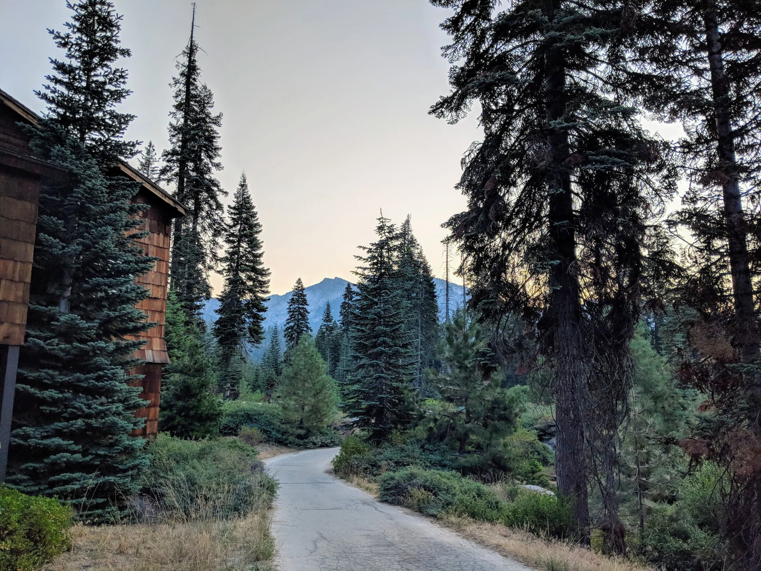
Sunrise outside of our room at Wuksachi Lodge
After spending an August Sunday morning in Kings Canyon, we drove the Generals Highway into Sequoia. We were struck by the lush, green forests, reminiscent of our home state of Washington. Having lived for several years in the Sierra foothills we were familiar with the blistering hot, dry, brown summers of California. Here the cool breeze wafted through the green leaves. We would learn that this is part of the appeal of this park so easily accessible from the San Joaquin valley. We drove to the Wuksachi Lodge where we had secured a last minute reservation at a reasonable rate. We checked in at the main lodge, following the instructions to leave our luggage in the car. This we learned was because the rooms were all located in other buildings a few hundred yards away. We parked and unloaded our ample luggage, cooler and other items onto a luggage cart and began the trek uphill to our building. This was no easy task, the cart heaving under the weight of our belongings and threatening to break free and race back downhill. We made it to our room which, if not luxurious, was more than sufficient in this remote location. Our air conditioner was window mounted and we had been warned about the limited wi-fi, but our room felt clean and nice with great amenities for a place which felt so far removed from the rest of the world. Our dinner reservation was not for a couple hours so we drove to Lodgepole Village where we shopped in the market, checked out the museum and found some delicious ice cream to hold us over. Back at the hotel we cleaned up for dinner and walked back to the main lodge. We had been warned of high bear activity in the area. It was said that a mother bear and her two cubs had been frequenting this location. We enjoyed our dinner and the friendly service in the pretty dining room with huge picture windows. We couldn’t say no to more ice cream - lavender flavor! With half a hamburger each boxed up and in hand we were a little more leary on the return walk to our room, but there was no bear encounter.
Top of Moro Rock
The next morning we were up early. We watched a mother deer and her still spotted fawn from our window. We struggled with our luggage cart on the downhill trek to our car and then drove to the General Sherman trail. We were the first and only ones in the parking lot and as we got out of the car, bear warning signs everywhere, the smell of the last night’s leftovers streamed from our cooler and seemed to sit like a cloud around our car. We quickly walked the half mile down to the General Sherman tree, but the return trip uphill, at least for me, was slower going. We could picture the bears on top already in our car enjoying what was supposed to be our lunch. Sarah ended up running up the hill to the top to assess the situation. I’m not sure what we planned to do if there was a bear but thankfully there was not. I swear you could smell those burgers across the parking lot. The restroom on top appeared to have been ransacked the night before by something inhuman, whether it was a bear or some smaller culprit we don’t know. But we felt glad to escape that area with our burgers still intact.
“Golluming” to the top of Moro Rock
Our next stop was Moro Rock. Sarah was acting a little strange about this adventure, seeming to withhold the details from me, which made me suspicious I would not like it. But her grandfather and his brother, both in their eighties, had mentioned that they enjoyed this hike and she had reluctantly shown me a picture which didn’t seem too bad. I was confident I could climb the 300 plus stairs to the top. The picture showed handrails so what could go wrong? I started off behind her full of confidence, which quickly dissolved. It seems that I am afraid of ledges. I have never been afraid of heights and hadn’t considered this possibility, but there it was. Sarah went on ahead and I followed along slowly. The handrails were simple metal pipes on the edge and too low making me think I could trip and flip over them at any minute. I kept to the inside with both hands clinging to the rock walking with my legs bent to lower my center of gravity. In this way, on that day, I coined the phrase “Golluming” as I looked a lot like the “Lord of the Rings” creature moving along the rock. I made it to the top with no desire to go back down. Sarah promptly hopped over the guardrail on top and asked me to take her picture and I promptly had a heart attack. I gingerly moved out to the end of the railing for my photo. As expected the descent was even worse and although the view was breathtaking, both literally and figuratively for me, I was happy to get back to the car.
From here we drove to Tunnel Log, an activity much more my speed. We drove through a couple times and then headed out of the park. Not far down the Generals Highway, headed toward Three Rivers, we ran into road construction and delays. As we waited for the pilot car to guide us down we ate our burgers and laughed about the day’s events. The drive down was steep and narrow with sharp turns. We stopped at the visitor center at the bottom to collect our passport stamps and headed out of the park. Soon we were back in the hot, dry valley feeling as if we had just imagined that cool, green forest high above us, truly an enchanted place.
Tunnel Log


